Kiribati
From Halal Explorer
Kiribati (pronounced Kiribahs) is an archipelago nation in Micronesia, at the equator. Kiribati has 3.5 million square kilometers of sea territory, with only 811 square kilometers of land, divided between 33 atolls.
While the islands are on both sides of the 180th meridian and the International Date Line has been drawn east of them all, placing Kiribati islands in the same day, in time zones UTC +12, +13 and +14. The Line Islands are in the latter time zones, and are therefore the first part of Earth to see every new day.
Kiribati is one of Oceania's poorest countries, and a demanding destination, with few hospitality venues. That said and there aren't many countries where the people are more friendly.
Regions of Kiribati
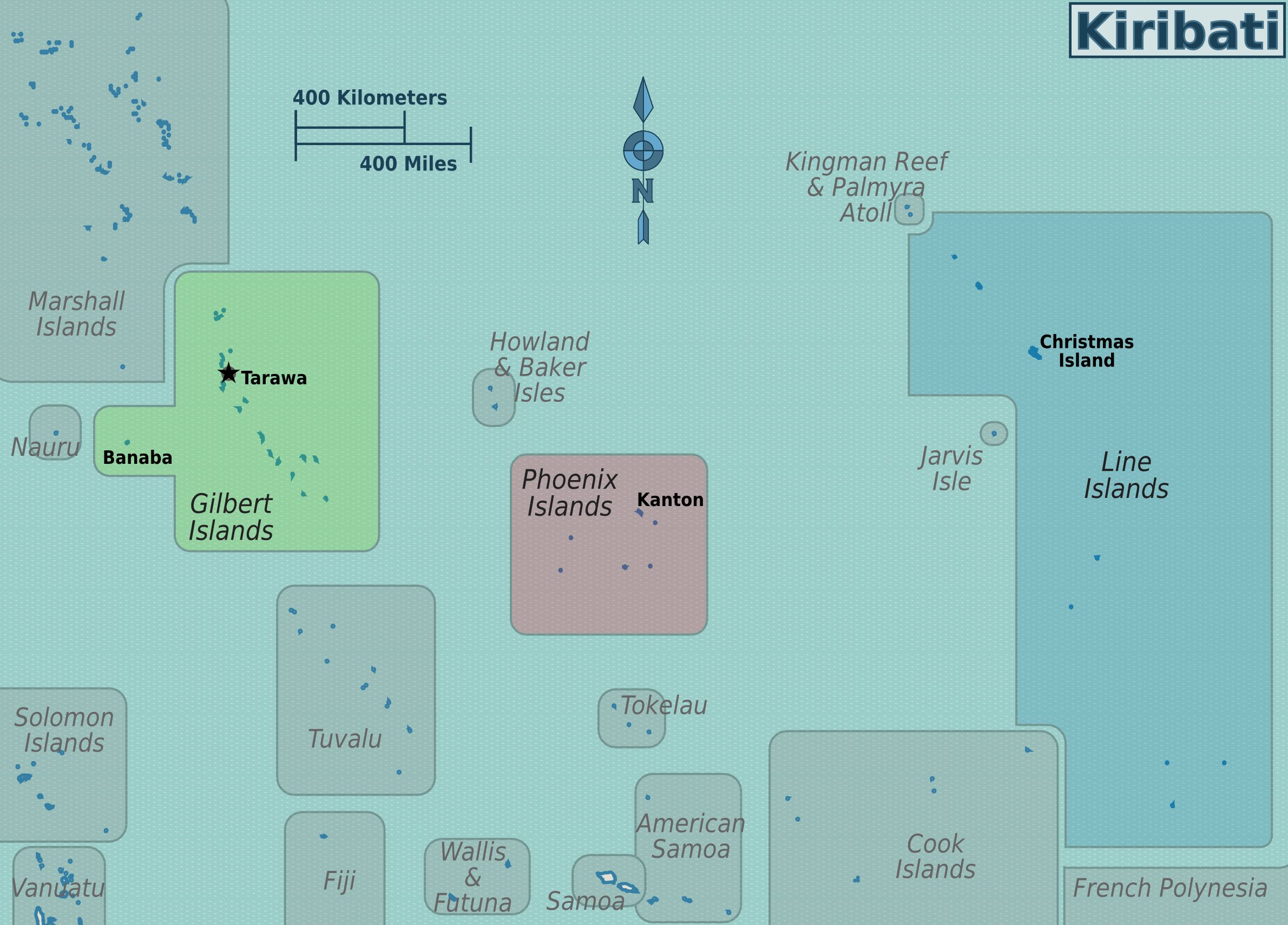
Except for Banaba (Ocean Island - 6km²/2.3 sq mi, population c. 300), all the main islands are in one of three groups: the Gilbert Islands and the Line Islands, and the Phoenix Islands.
| Gilbert Islands The western island chain is home to the vast majority of Kiribati's population, including the capital Tarawa. |
| Line Islands (Kiribati) The farthest flung islands, with populations on the three northern islands of Kirimati (Christmas Island), Tabuaeran, and Teraina. |
| Phoenix Islands Almost completely uninhabited, with the exception of a few families on Kanton. |
Reference ##3d1a0 Gilbert Islands]].
Reference ##ebcc2 Line Islands (Kiribati) | Line Islands]].
Reference ##eb1b3 Phoenix Islands }}
Cities
- Tarawa
Kiribati Halal Travel Guide
Copyright 2015 - 2024. All Rights reserved by eHalal Group Co., Ltd.
To Advertise or sponsor this Travel Guide, please visit our Media Kit and Advertising Rates.

